


Geocaching Adventures in Florida: Hidden Treasures in Nature
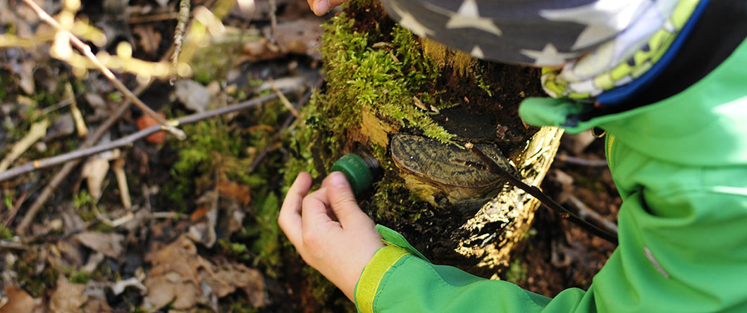
Somewhere along a spring run in Gilchrist County there is a weatherproof container about the size of a sandwich box, tucked at the base of a cypress and holding nothing more valuable than a damp logbook and a handful of plastic trinkets. Thousands of people have walked past it. A few hundred have gone looking for it on purpose, coordinates in hand, and found it in under ten minutes.
That gap between walking past something and going to find it is the whole appeal of geocaching. The game turns a familiar trailhead into a destination, gives a long drive a reason to stop, and rewards the kind of slow, close attention that most outdoor recreation does not require. Florida happens to be unusually good terrain for it.
What Is Geocaching and Why Florida Is One of the Best States to Do It
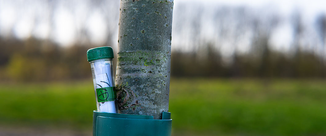
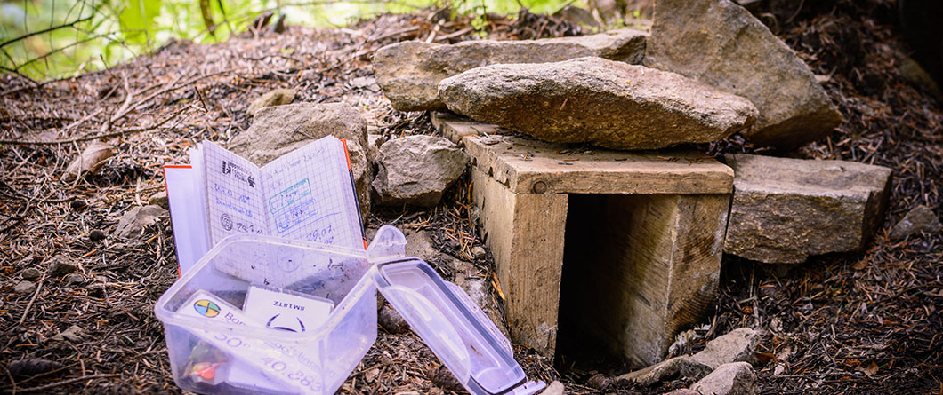
Geocaching is an outdoor treasure hunt played with a smartphone or a handheld GPS device. One player hides a container and posts its coordinates online, and other players navigate to within a few feet of that spot and start searching. The container might be a magnetic capsule the size of a thumbnail stuck to a trail marker, or a surplus ammo can holding a logbook, a pencil, and small tradeable items. You sign the log, swap a trinket if the cache is large enough, return everything exactly where you found it, and record the find in your account.
The scale of the game surprises most newcomers. Players posted a record 88.5 million “Found it!” logs in 2024, which means the odds of a cache sitting within a mile of wherever you are reading this are considerably better than even. Caches exist in city parking lots and national forests alike, with difficulty and terrain ratings that let you filter for a two-minute urban find or a half-day slog through palmetto scrub.
Florida earns its reputation among cachers for a few practical reasons. The state has an enormous amount of publicly accessible land, and much of it is managed by agencies that actively welcome caching rather than tolerate it. The season never closes, so a January cache run and an August cache run are both viable with the right timing. Habitat variety within a two-hour drive is hard to match anywhere else in the country, which means a single weekend of geocaching in Florida can cover pine flatwoods, a spring-fed river, a barrier island, and a historic downtown without much repetition. Cachers also benefit from the state’s trail infrastructure, since many of the best geocaching spots sit along existing hiking trails and paddling routes that already have parking, signage, and maintained access.
August caching calls for a schedule adjustment more than anything else. Start early, carry more water than the mileage suggests you need, plan around afternoon storms, and treat long grass and palmetto stands as tick and snake habitat, because they are. Morning finds in shaded hammocks and along spring runs stay comfortable well into the summer, and the caches there tend to be better placed anyway.
What Is Geocaching and How Does It Work?
Geocaching is a GPS-based outdoor treasure hunt in which players use published coordinates to locate hidden containers, and it has grown to over 3 million geocaches worldwide since the first cache was placed in 2000. Players find a cache listing on Geocaching.com or in the free official app, navigate to the posted coordinates, search the immediate area for the container, sign the paper logbook inside, replace the cache exactly as found, and then log the find online. A free basic membership covers everything a beginner needs.
Florida State Parks Geocaching Program: Operation Recreation GeoTour and Nature Cards
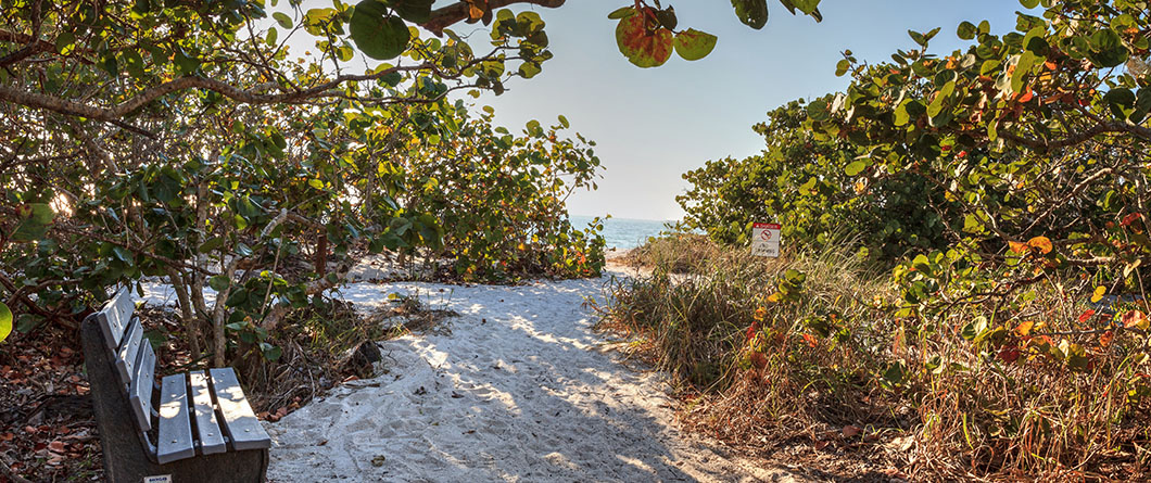
The single best entry point for geocaching at state parks in Florida is a program the Florida Park Service has run for more than a decade. Operation Recreation GeoTour, hosted on Geocaching.com, places caches in parks and trails stretching from Pensacola to Key West, and the tour serves as a curated tour of the park system disguised as a treasure hunt. Rather than hunting caches at random, you work a published list, and the list happens to route you through the parks the state considers most worth seeing.
The mechanics are simple. Download and print the official tracking sheet, find caches as you travel, and log them. Twenty finds earns the official Operation Recreation Geocoin, a physical trackable that most cachers keep rather than release back into circulation. Standard park entry fees apply at each stop, so anyone planning a serious run at the tour usually buys a Florida State Parks annual pass early and stops thinking about the gate cost.
The Kids GeoTour uses the same caches but with a different objective. Inside each Operation Recreation cache is one of six nature cards, and every card features a different Florida species. Children record the name of the park where they first find each species, and completing all six earns a separate Kids GeoTour geocoin. The design does something clever for younger participants, since a child who is only mildly interested in finding a plastic box becomes considerably more interested when the box contains a card they still need.
Individual park caches carry their own descriptions, which is where the program earns its keep as an interpretive tool. The Operation Recreation cache at Jonathan Dickinson State Park sits in a park covering over 10,000 acres with 16 different natural communities, including sand pine scrub, pine flatwoods, mangroves, and river swamp along the Loxahatchee. Cachers who show up for the find frequently stay for the Trapper Nelson homestead tour or a paddle upriver, which is exactly the outcome the park service was after when it placed the cache.
How Does the Operation Recreation GeoTour Work?
Operation Recreation GeoTour participants collect the official geocoin by finding 20 caches across the 71 Florida state parks and trails included in the tour, which runs from Pensacola to Key West. Players download and print the official tracking sheet from the Florida State Parks website, log each find on Geocaching.com, and record park names as they go. A parallel Kids GeoTour uses the same cache locations, with participants collecting six species nature cards to earn a separate children’s geocoin.
North Florida Geocaching: Natural Springs, DeSoto Trails, and the Forgotten Coast
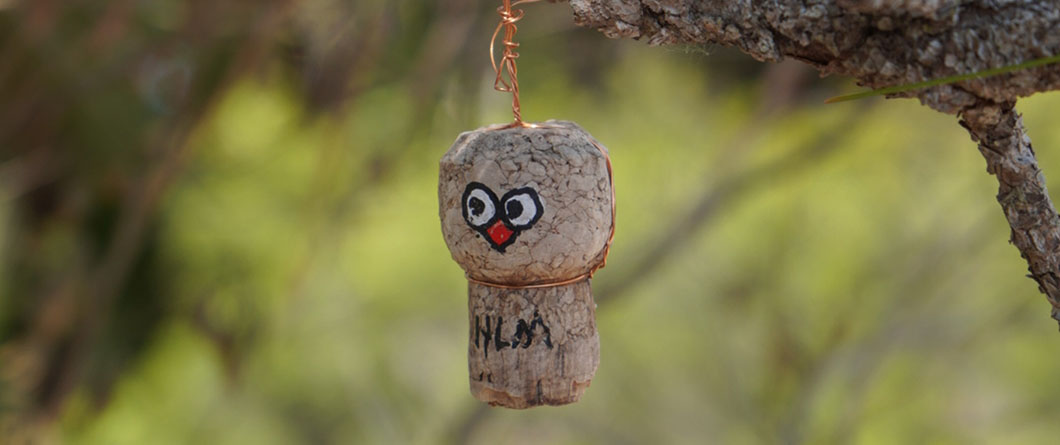
North Florida geocaching runs through the state’s most geologically distinctive region. Florida holds more than 1,000 springs, representing what may be the largest concentration of freshwater springs on Earth, and the densest cluster of them sits across the north-central counties where the aquifer comes closest to the surface. Cache hiders have made thorough use of that terrain. Spring parks and their surrounding trail systems hold caches in tree hollows, under boardwalk supports, and along the sandy uplands above the run, and the caching is generally pleasant in summer because the hardwood canopy and the 72-degree water moderate everything around them.
The region’s heritage caching adds a second layer. Natural North Florida has long promoted a Hidden Treasures series that highlights off-the-beaten-path places across the region, built around the DeSoto Trail corridor that Spanish explorers cut through the interior, and the Spanish, Native American, Civil War, and cracker heritage layered along it. Caches in this vein tend to be placed at small museums, historic cemeteries, courthouse squares, and river crossings in towns most travelers pass through without stopping. Finding them tends to produce a better afternoon than the itinerary you had planned.
The Forgotten Coast covers the quietest caching in the state. Franklin County protects 53 miles of largely undeveloped mainland coast, plus the barrier islands that shelter it, and the geocaching density there is higher than the population would suggest, with an estimated 200 or more cache sites between Alligator Point and the county’s western edge. Bald Point State Park and St. George Island State Park both participate in Operation Recreation, which gives tour completers a reason to work the coast rather than skip it. Caches on Little St. George and St. Vincent Island require a boat and reward the effort with terrain ratings that most Florida caches cannot approach. Anyone building a caching route through the Northwest Florida region should plan around tides and boat access rather than drive time.
Central Florida’s Trek Ten Nature Trails: Celebrate Nature Passport and Hidden Cache Locations
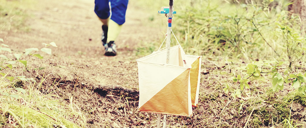
Central Florida geocaching has its own program, and it predates most of the state’s organized caching by several years. Trek Ten Trails is a free program launched in 2007 by the Friends of the Parks in Polk County, designed to get families out of the house and into the county’s parks and nature preserves. Each cycle features a rotating set of trails, and every featured trail holds a geocache that can be located either by GPS coordinates or by following written directions on the trail factsheet, which removes the technology barrier for anyone who would rather not fuss with an app in the field.
The passport structure is what keeps participants coming back. Trekkers pick up a game card, hike the featured trails, and validate progress by finding the cache on each one and using the self-inking stamp stored inside it. Ten different stamps completes the card. Finished cards go back to the program coordinator, and completers receive a certificate and a souvenir token at an annual celebration held at Circle B Bar Reserve. Game cards are available at Polk County public libraries and at Circle B Bar Reserve, or downloadable from the program site.
The trail selection is the underrated part of the program. Coordinators deliberately spread featured trails across the county and mix distances so the ten-stamp goal stays achievable for families with young children, and trails rotate out every couple of years to keep the cycle fresh for repeat participants. Past cycles have featured Gator Creek Reserve, Se7en Wetlands Park, Lewis Arboretum, North Walk-in-Water Creek, and Bonnet Springs Park, which is a spread of habitat most Central Florida residents never get around to visiting on their own. Because each factsheet includes complete cache-finding instructions along with trail specifics, the program doubles as a self-guided introduction to the county’s conservation lands.
Anyone working Trek Ten Trails should check the current cycle’s factsheet list before heading out, since featured trails and game card deadlines change from year to year. The broader Central Florida region supports plenty of caching outside the program as well, with dense placement around the Green Swamp, the Van Fleet corridor, and the chain-of-lakes parks north of Orlando.
South Florida Geocaching Adventures: Great Calusa Blueway and Fort Myers Blueway Launch Sites
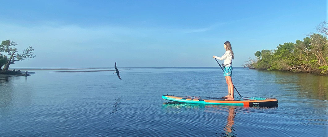
South Florida geocaching turns water access into the defining variable, and nowhere illustrates that better than Lee County. The Great Calusa Blueway is a marked paddling trail winding through Pine Island Sound, Estero Bay, the Caloosahatchee River, and its tributaries, guided by brown-and-white signage that routes paddlers through shallow water away from powerboat traffic. Caches placed along the corridor sit at launches, landings, and shoreline parks, and reaching some of them requires a boat rather than a car.
Launch sites function as the practical skeleton of a Blueway caching route. There are more than 40 marked launch sites identified on the trail maps, with additional access points beyond those, and the trail divides into three phases covering Estero Bay, Pine Island Sound, and the Caloosahatchee. An average paddler covers about three miles per hour, which makes a two-cache morning realistic and a six-cache day ambitious. Phase 1 and Phase 2 carry physical markers on the water, while Phase 3 follows the linear river with GPS coordinates published for tributary mouths instead, so cachers working the Caloosahatchee should download coordinates in advance rather than count on visual navigation.
The wildlife is the reason to slow down between finds. The Blueway corridor passes through Estero Bay, Florida’s first aquatic preserve, and paddlers regularly encounter wading birds, dolphins, manatees, sea turtles, and river otters along the same shorelines where the caches sit. Cachers who normally hunt on foot find that a paddling approach changes the pace of the game considerably, since the transit between caches becomes the better part of the day.
Elsewhere in South Florida, the terrain rewards a different strategy. Caches in the Everglades corridor and the Big Cypress region tend to be sparse and hard-won, while the coastal parks in Martin, Palm Beach, and Broward counties hold high-density placements suitable for quick urban runs. Summer caching this far south demands early starts and serious insect preparation, particularly anywhere near mangrove edges at dawn and dusk.
Can You Go Geocaching From a Kayak in Florida?
Yes, and Lee County’s Great Calusa Blueway is the most developed water-based caching route in the state, with caches positioned along a 190-mile trail that meanders through the county’s coastal waters from Pine Island Sound to Estero Bay and up the Caloosahatchee River. Paddlers download free trail maps and GPS coordinates online, launch from one of the marked access points, and navigate to caches placed at launches, landings, and shoreline parks. Waterproof phone storage and a dry bag are standard equipment, since many finds require stepping out of the boat at a landing.
Sebring GeoTour: Four GeoTrails Across Ranch, Historic, Parks, and Art and Culture Routes
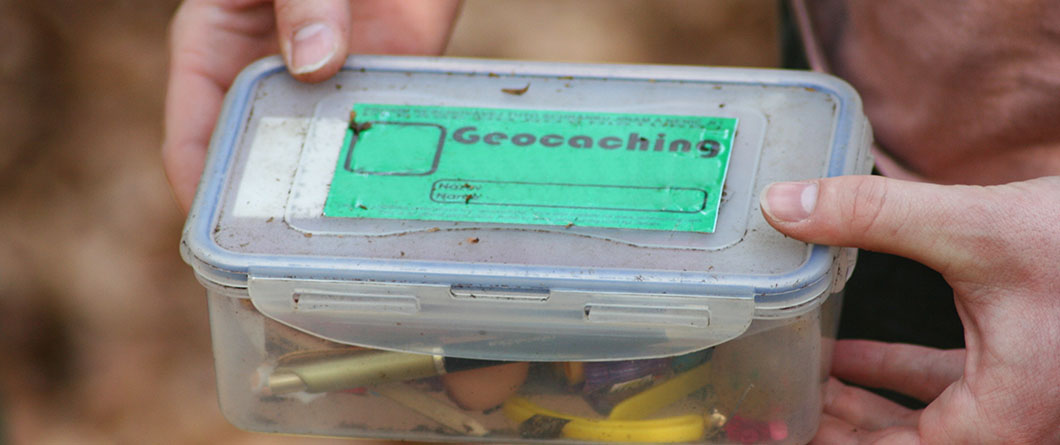
Geocaching in Sebring, Florida, delivers the most deliberately designed caching experience in the state, and it exists because Highlands County decided to build one. The Sebring Area GeoTour routes cachers across four GeoTrails covering Ranch and Harvest, Parks and Recreation, Historic, and Art and Culture, each one anchored to a different facet of the region. Caches sit at cattle ranches and citrus groves, museums and historic sites, county parks, and the mural districts that made Lake Placid locally famous.
The geography stretches beyond Sebring itself. Cachers working the tour pass through Avon Park, Lake Placid, Lorida, and Venus, which is a slice of interior Florida that most travelers experience only as a stretch of US 27 between Orlando and the Gulf. The Ranch and Harvest trail, in particular, puts cachers on working agricultural land they would otherwise have no reason to visit, and the Art and Culture trail routes them through the Lake Placid murals at a walking pace rather than a windshield glance.
Completion works on a passport system. Download the GeoTour passport, log the required number of caches, posters, and Adventure Labs, then submit the finished game sheet to Visit Sebring by mail or email to receive the official geocoin. The Adventure Lab components are worth understanding before you go, since they run inside a separate app and involve answering location-based questions rather than finding a physical container, and cachers who show up expecting only traditional hides sometimes miss them entirely.
Highlands Hammock State Park sits inside the same area and participates in the state’s Operation Recreation tour, which makes a combined weekend efficient. Anyone building a full Central Florida caching itinerary can reasonably pair the Sebring tour with the Polk County trail program to the north without adding much drive time.
How Many Caches Are on the Sebring Area GeoTour?
The Sebring Area GeoTour consists of 37 caches, two Adventure Labs, and eight posters hidden across Sebring, Avon Park, and Lake Placid in Highlands County. Cachers navigate the tour’s four themed GeoTrails using a GPS device or smartphone, download the official passport, and log finds as they go. Submitting a completed passport to Visit Sebring earns the official geocoin, and a free basic Geocaching.com membership covers everything needed to participate.
Family Geocaching in Florida: Tips for Getting Kids Involved in Outdoor Treasure Hunts
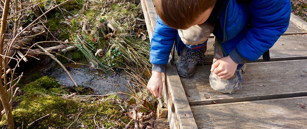
Family geocaching in Florida works because the game gives children a job. A hike with no destination is a negotiation, while a hike with a hidden container at the end of it becomes a mission, and the difference in cooperation is dramatic enough that parents tend to notice it on the first outing. The state’s programs lean into this. The Florida Park Service runs a Kids GeoTour on the same cache locations as the adult tour, where children search inside each container for one of six possible nature cards, record the park where they first found each species, and earn a dedicated children’s geocoin for collecting all six.
Cache selection matters more than anything else with young kids. Difficulty and terrain ratings run on a five-point scale, and anything rated above 2 on either axis will frustrate a six-year-old. Filter for regular and large container sizes, since small children find ammo boxes and lunchbox-sized containers satisfying in a way that micro caches hidden in guardrail bolts never are. Read recent logs before driving anywhere, because a cache with three consecutive “did not find” entries is probably missing, and a wasted trip sours the whole idea.
Build the trip around trading rather than finding. Larger caches contain small tradeable items, and the rule is simple enough for a four-year-old to grasp, since you take something only if you leave something of equal or greater value. Kids who arrive with a bag of trade items they picked out themselves stay invested through several finds, and a child who understands they might swap a plastic dinosaur for a marble will search a palmetto stand with more diligence than any adult on the trip.
Summer logistics deserve real planning with children along. Morning starts, shaded trail systems, generous water, and a hard stop before the afternoon heat peak will keep the outing pleasant. Teach the replacement rule early and enforce it, since the cache goes back exactly where it was found, camouflage and all, and children who learn that habit at seven become cachers who do not wreck hides at seventeen. Pair the finds with something else the site offers, whether that is a spring swim, a boardwalk, or a birding stop, so the day holds up even if one cache turns out to be missing.
How to Start Geocaching in Florida: Apps, GPS Devices, and Geocaching.com Setup Guide
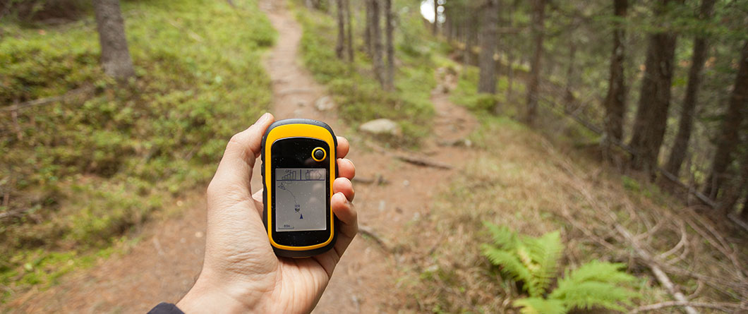
Getting started costs nothing. Sign up for a free basic account at Geocaching.com, then either use the website or download the free official Geocaching app, which handles searching, navigation, and logging in one place. The Florida Park Service walks new players through the process the same way, advising cachers to register a free account and search by the ZIP code of the park they plan to visit, then select caches and load coordinates before heading out. Anyone using a handheld GPS unit can send coordinates directly to the device and go paperless, which still matters in parts of the state where cell coverage thins out.
Phone versus dedicated GPS comes down to where you cache. A modern smartphone is accurate to within a few meters and sufficient for the overwhelming majority of Florida caches, including everything along paved trails, in developed parks, and around town. A dedicated unit earns its price in three situations, which are deep public land with no signal, extended time outdoors where phone battery becomes a limiting factor, and any water-based caching where a rugged waterproof device beats a phone in a dry bag. A basic handheld runs a fraction of what most people expect.
What you carry matters as much as what you navigate with. A pen is not optional, since logbooks in older Florida caches are frequently damp and the pencil stub inside has usually gone missing. Add tweezers for extracting rolled logs from micro containers, a small flashlight for looking into hollows even in daylight, hand sanitizer, and a supply of trade items if children are along. Florida-specific additions include insect repellent, closed-toe shoes for anything off pavement, and more water than the mileage suggests.
Read the cache listing completely before you search. The description, the difficulty and terrain ratings, the hint, the container size, and the recent activity logs together tell you almost everything about what you are walking into. A cache with a terrain rating of 4 in Florida usually means water access, a long hike, or a climb, and the state has few of the third category. Attributes on the listing flag whether the site allows dogs, requires a park fee, needs special equipment, or sits on land with seasonal access restrictions.
Permissions and etiquette carry real weight in Florida, where a large share of caching happens on managed conservation land. Several county park systems require hiders to obtain permission or a permit before placing a container, and some preserves restrict placement entirely to protect sensitive habitat, so anyone planning to hide caches rather than only find them should contact the land manager first. Search without digging, disturbing vegetation, or permanently moving rocks and logs. The community’s own Cache In Trash Out initiative has logged more than 599,000 attendances at nearly 33,000 cleanup events since 2002, and the ethic behind it is what keeps land managers receptive to the game. Carrying a trash bag on an ordinary cache run is the simplest version of the same idea and fits naturally alongside broader conservation practice on Florida’s public lands.
What Do You Need to Start Geocaching in Florida?
Starting requires a free basic membership on Geocaching.com, either the free official app or a handheld GPS device, and, per the Florida Park Service, new players should register an account and search by ZIP code for the park they want to explore. Beyond navigation, bring a pen for signing logbooks, tweezers for rolled logs in small containers, water, insect repellent, and closed-toe shoes. Park entry fees apply at state parks, and an annual pass pays for itself quickly for anyone pursuing the Operation Recreation GeoTour.
Frequently Asked Questions About Geocaching Adventures in Florida
Is geocaching free in Florida?
The game itself is free. A basic Geocaching.com membership and the official app cost nothing, and they cover the large majority of caches in the state. Premium membership unlocks member-only caches and advanced filtering, which serious cachers tend to find worthwhile after a few months. The real cost of caching in Florida is park entry, since most state parks charge a vehicle fee, and an annual pass is the practical solution for anyone working through the Operation Recreation GeoTour.
Do I need a GPS device, or will my phone work?
A smartphone works for nearly all caching in Florida. Modern phone GPS is accurate to within a few meters, which is close enough for any cache with a reasonable terrain rating. A dedicated handheld unit becomes worthwhile for remote public land with unreliable cell service, all-day outings where battery life matters, and water-based caching where waterproofing and durability count.
What is the best time of year to go geocaching in Florida?
October through April offers the most comfortable conditions statewide, with lower humidity, fewer insects, and better visibility in vegetation that has died back. Summer caching remains entirely viable with schedule adjustments, including early-morning starts, shaded trail systems, spring-fed sites, and a hard stop before afternoon storms. Winter caching in South Florida is excellent year-round by most standards.
Are there geocaches in Florida state parks?
Yes. Operation Recreation GeoTour places caches across 71 state parks and trails between Pensacola and Key West, and finding 20 of them earns the official geocoin. Parks, including Jonathan Dickinson, Highlands Hammock, Bald Point, and St. George Island, participate. Standard park entry fees apply, and the tracking sheet is available for download from the Florida State Parks website.
Is geocaching safe with young children?
It is, with sensible cache selection. Filter for low difficulty and terrain ratings, choose regular or large containers, and read recent logs to confirm the cache is still in place. Florida-specific precautions include watching for snakes in palmetto and tall grass, checking for ticks afterward, applying insect repellent, and keeping children on established trails rather than letting them bushwhack toward a coordinate.
What is Cache In Trash Out?
Cache In Trash Out, usually shortened to CITO, is the geocaching community’s environmental initiative, which has been running since 2002. Organized CITO events bring cachers together for litter cleanups, invasive species removal, planting, and trail work on public land. Many cachers also practice an informal version by carrying a bag and collecting trash during ordinary cache runs, a habit that has made land managers across Florida receptive to hosting caches.
Can I hide my own geocache in Florida?
You can, though placement rules vary by land manager, and Florida has more restrictions than most states because so much caching happens on conservation land. Several county park systems require permission or a permit before placement, some preserves prohibit caches entirely, and state parks handle their own approvals. Contact the managing agency before placing anything, then submit the listing to a Geocaching.com volunteer reviewer for publication.
What should I do if I cannot find a cache?
Check the hint on the listing first, then read the most recent logs to see whether other cachers have found it lately. Reset your position by walking away 30 or 40 feet and approaching again, since GPS accuracy degrades under tree canopy and near buildings. If several recent entries report the same failure, the cache is likely missing, so log a “did not find” and move on. Those logs are how cache owners know to check on a hide.
